Volcanism,
tectonism, sedimentation, and the peleoanthhropological record in the
Ethiopian Rift System <>
PDF file
Structure and evolution of the main Ethiopian rift
PDF file
Overview of Geothermal Resource Utilization and Potential
in Eastern Africa, East Africa Rift System <> PDF file
Evolution of the Afar Depression from Orbital Optical
and Radar Image
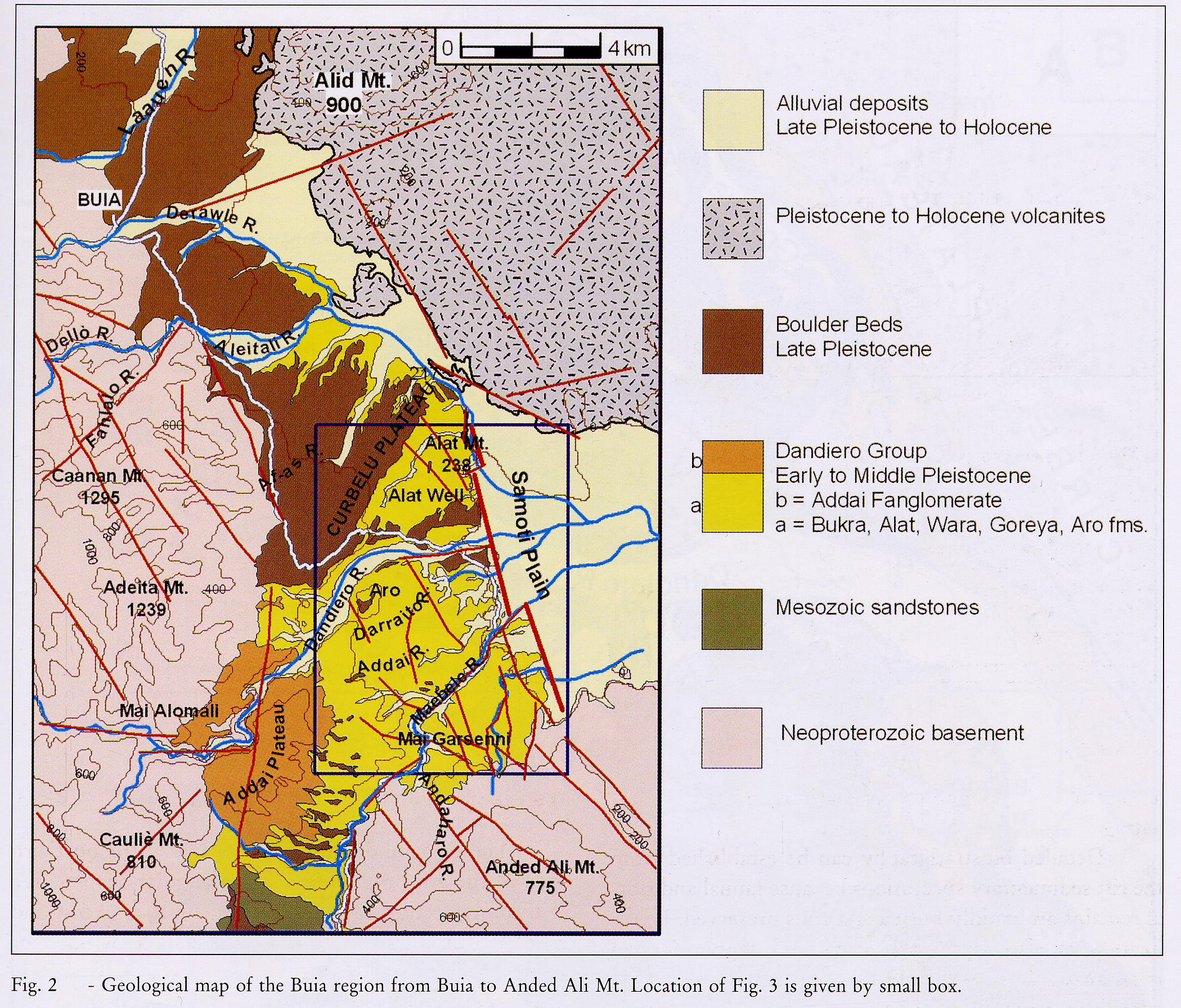
Geological Map of the Buya Region from Buia to Anded
Ali Mount <>1.1 MB .jpg file
Geological Map of the Rift Valley in Eritrea's Coastal
Area and Tigray from Massawa to the Bay of Assab <> 1.7 MB .jpg
file <> (This is a section of the Geological Map of Ethiopia)
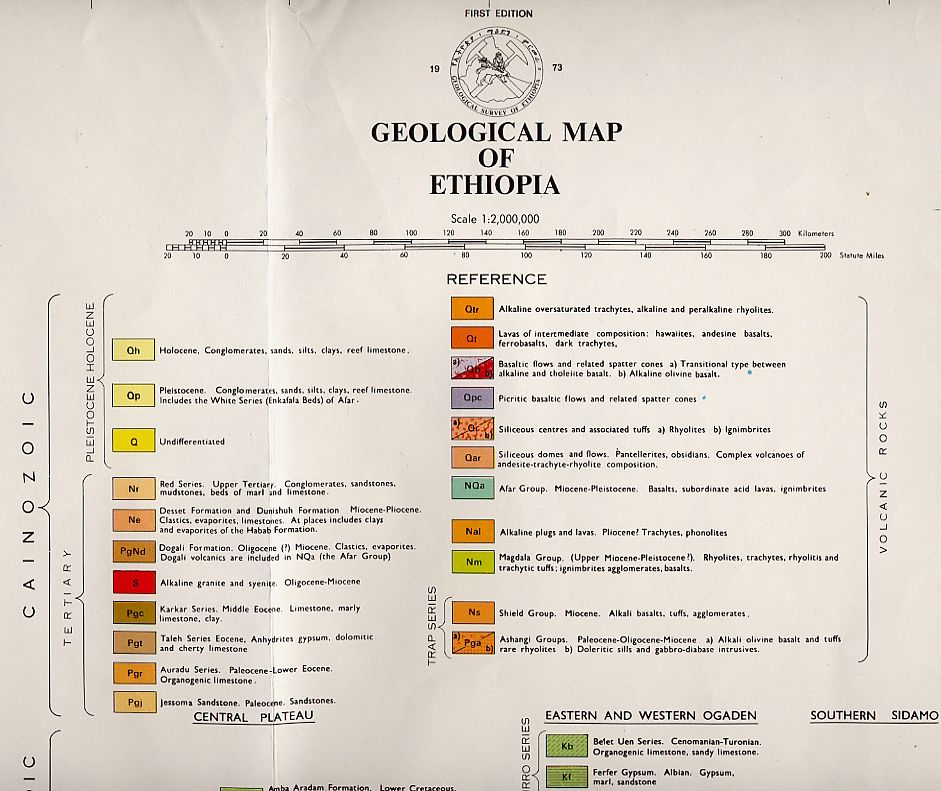
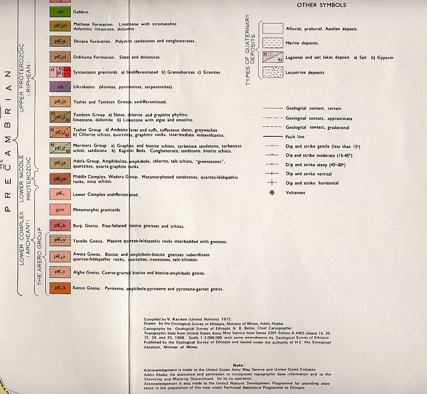
Legend for the Geological Map of Ethiopia: Section
1 <==> Section
2 <==> Section
3 (.jpg files)
Explanation of the Geological Map of Ethiopia
3D Perspective Model of the Afar Depression
Regional and local deformations at Erta Ale caldera
(Afar, Ethiopia)
US-EAGLE (Ethiopia-Afar Geoscientific Lithospheric
Experiment): Modification of lithospheric structure during continental
break-up
Geologists witness 'ocean birth'
Assayta (Ethiopia) Focus on the Afar People
The Mineral Industries of Djibouti, Eritrea, Ethiopia
and Somalia <> PDF file
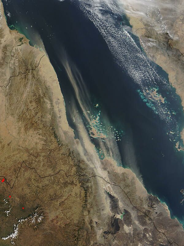
Eritrea Dry Lake Source (A satellite picture showing
a sandstorm along the Red Sea Coast)
Satellite
view of the southern Eritrean coast
Researchers Investigate Mysteries Of The African Rift
Socio-Economical Notes on the Danakil Region ~ Relation
on the Mission in the Danakil Region carried out from 3 to 16 February
1994
![]()